I was given the chance to join the
Mt. Kitanglad to
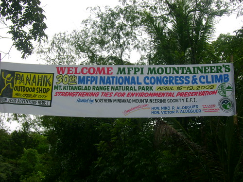
Mt. Dulang-dulang traverse, a double summit climb at the beautiful province of Bukidnon last April 16-19, 2009. This activity was sponsored by the Mountaineering Federation of the Philippines, Inc. (MFPI) through its member organization from the southern part of the country, the
Northern Mindanao Mountaineering Society Ecological Foundation, Inc. (NORMMS) on the occassion of their 3
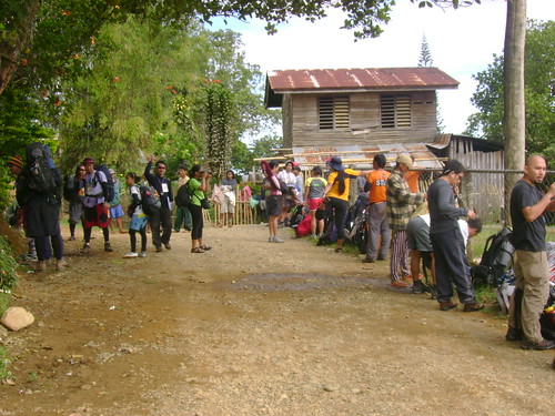
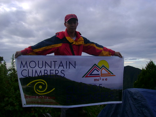
0th MFPI National Congress and Climb with the theme: "Strengthening Ties for Environment Preservation." This gathering of mountaineers was participated by more than 50 mountaineering clubs and 250+ participants all over the country divided into 4 different groups.
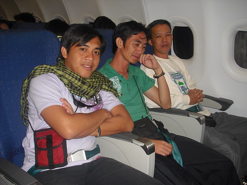
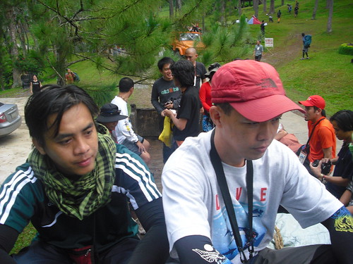
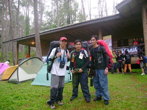
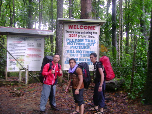
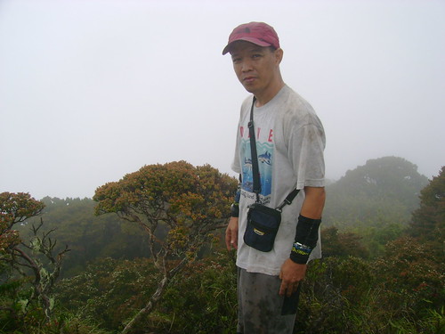
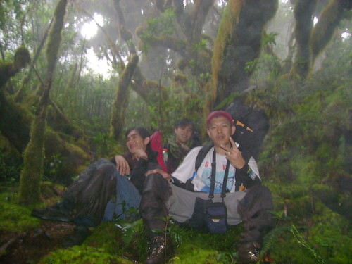
I was joined by Anthony Dublin, my former student at TUP-Cavite and his friend Ricky Recto. The three of us represent MCCE, one among the only few delegate clubs from the Luzon region. Our group was very fortunate to be accommodated for this climb since priorities were given to MFPI member organizations. At last, by April 1, the secretariat (Mam Fam Villanueva) opened the registration to non-members and freelancers thus we were given the privilege to join.
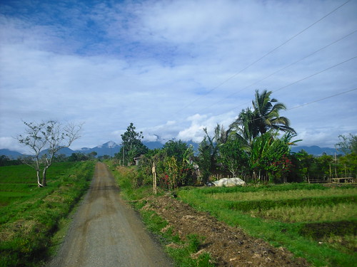
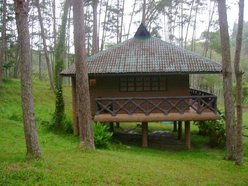
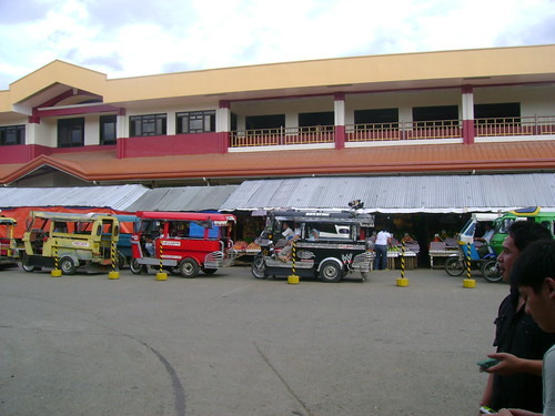
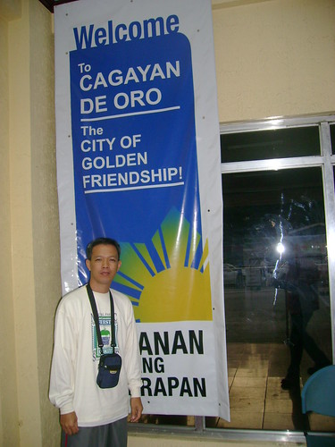
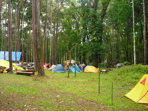
The entry point to Bukidnon is via Cagayan De Oro City. We traveled almost three hours from the city proper of CDO to Malaybalay, Bukidnon passing numerous mountain ranges on both sides of the road. After arriving at the bus terminal, my two buddies made some marketing for our supply needed for our scheduled 3-day trek. April 16 is assembly and registration which was done at the Kaamulan grounds, a multifunctional convention center characterized by pine trees covering the entire area. There are also
Bahay Tulugan which
can accommodate as many as 50 persons in one cottage. My group happened to be in one of the rooms together with the three from PATTS-MC.
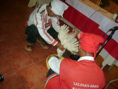
After the opening ceremony and some itinerary briefing, a ritual was made lead by two
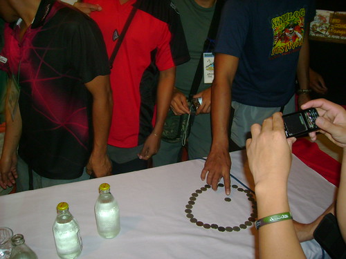
"datu" representing two of the four tribes inhabiting the Kitanglad mountain range. They offered prayers for us for their gods asking for our safety and deliverance on our planned expedition. Some of their rituals made were the offering of chicken bloods and partaking in the meat after cooking. Also, they asked us to offer P1 and P0.25 coins for their prayer and blessings. The P1 coin should be kept by us up to the time we descend of the mountain while the P0.25 coins will be offered to their god. White pieces of cloth should also be hanged at the summit of Dulang as respect to the mountain.
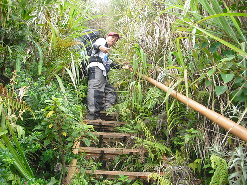
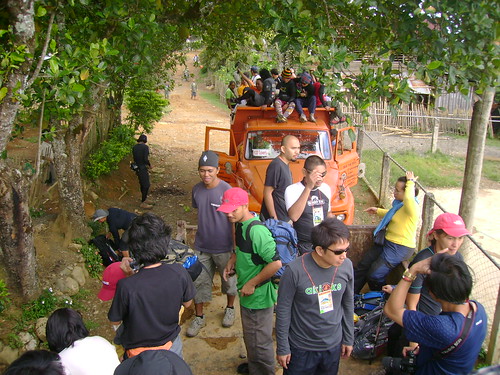
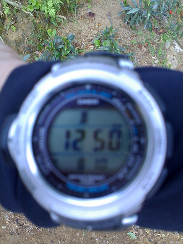
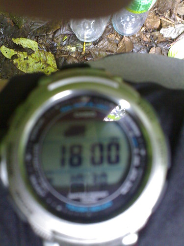
The next morning, our group (Group 1: K2D Traverse) was fetched by 2 dump trucks going to Barangay Intavas, our jump-off point going to Kitanglad. I checked my altimeter watch there and it registers 1250 MASL elevation at that point. We started the trekking by 8:20 am, beginning at a rugged rough road and slowly becoming steeper and narrower as it approaches the PAMB billboard showing that Mt. Kitanglad is a Natural Park. From here, the trail now becomes more challenging as we enter forested areas all the way to the summit. Water is also available here. You will approached a steep steel ladder made for the trekkers and people working at the summit. At 1800 MASL, the last water source is available, a short right turn from the main trail. From here, the next water available was at the summit of Kitanglad.
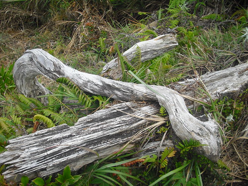
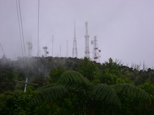
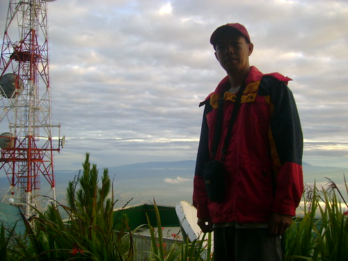
Generally, the trail to the summit is composed of steep ascent with occasional rolling. Mostly of the trail is below the electrical lines that supplies power to the many transmitters (two of which belongs to
Kapuso and
Kapamilya) erected at the summit. Also, 5 or 6 steel rails were fabricated on vertical walls of the trail which I presumed was sponsored by these TV stations or the provincial government of Bukidnon. Burned trees are also visible along the trail which according to locals are remnants of forest fire that happened some years ago at the Kitanglad range.
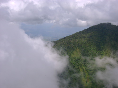
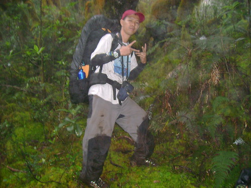
At last, we finally took a glimpse of the antenna at the summit which is an indication that we're now near the peak. Dwarf bamboos are also a common flora near the summit which reminds me of the Mt. Pulag grassland trail. By 4:00 pm, my group reached the Kitanglad summit having us included in the top 10 summiteers. A guy named Paulo Balderas from Sandawa Apo was the 1st to reached the summit.
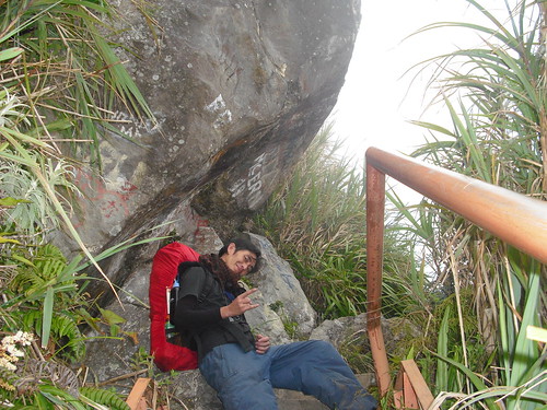
It's a good thing to know that a bunkhouse is available at the summit. We managed to secure one of the three rooms there. The room we occupied has 3 double decks exactly fitting for the 6 of us. The three of us and three from UPM. At least, we were spared the second time in pitching out tents outside especially considering the cold bite temperature and occasional rain showers.
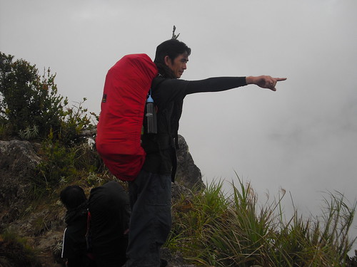
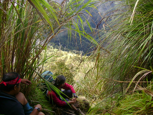
The next morning is a more strenuous trekking as the organizers have told us. According to the itinerary, it's a 12-hour trek from Kitanglad to Dulang campsite, the famous Manny's Garden. Again, 4:00 am is the wake-up call and we are expected to start the descent by 6:00 am via the connecting ridge at the southern part of Kitanglad. We packed our lunch again to save us time from cooking and minimize us of additional water load. By 6:30 am, our group together with some other started the descent to the ridge that connects Kitanglad and Dulang. After around 300 meters of plunge, the next leg is a 30-40 meter rappelling. This section is to be traversed one at a time. Safety is definitely in mind. You will be given signal by the staff if it's your turn to rappel. The trail next to this is characterized by
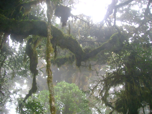
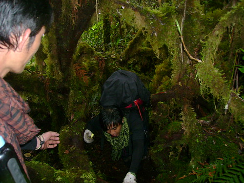
talahib with continues descent and occasional rolling. After passing the ridge, we now enter into the mossy forest characterized by trees with trunks and branches covered with leaves resembling like
lumot. This atmosphere, which reminds me of the Elven Forest in the Lord of the Rings trilogy, is common throughout the entire trail going to Dulang summit up to
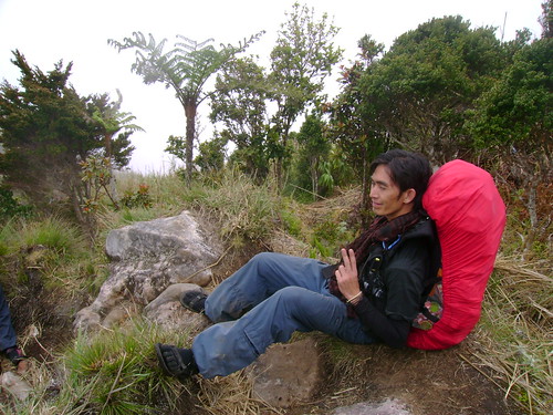
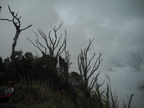
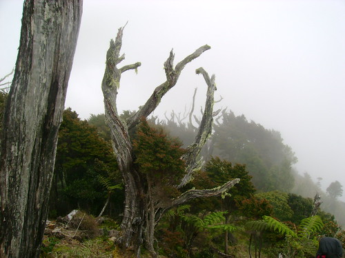
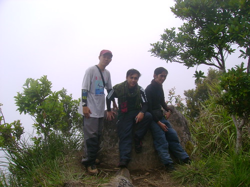
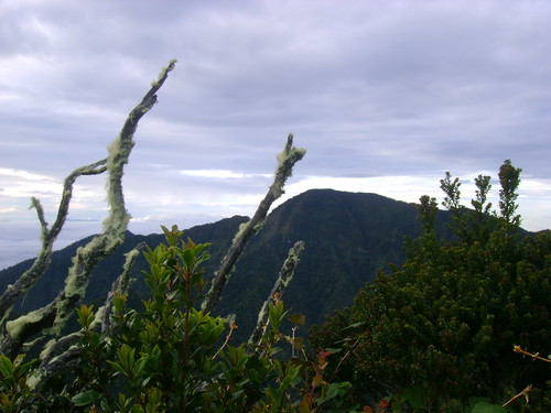
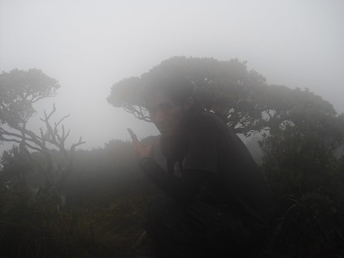
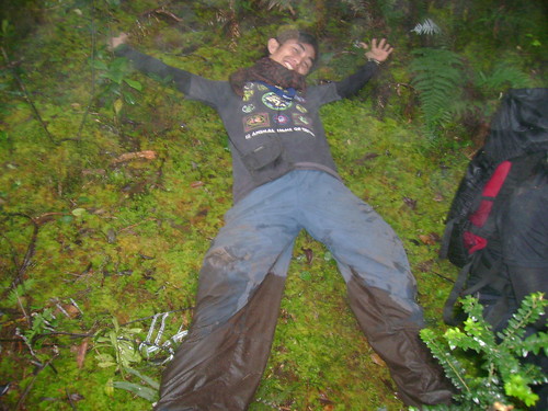
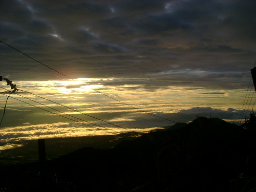
Hardin ni Mannny. One of the hardest part of the trail is again a vertical wall which you need to climb by gripping onto a rope while having your feet thread on a muddy and slippery wall. This section is manned by Sir Danny, one of the staff of NORMMS. Thanks you Sir for helping us to cross that obstacle. From this point, about an hour and we already reached the summit passing again to an enchanting forest. The moment we were at the peak, rain drops welcomed us so we just took our solo shots making that bonsai tree as our background and quickly headed towards the campsite. The time is around 2:00 pm when we reached the summit. There I noticed also the white pieces of clothes hanging in an improvised clothesline. I know that the staffs did this for us as part of the ritual in climbing this sacred mountain.
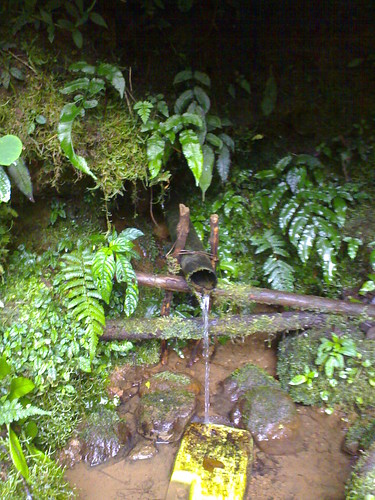
Our next objective is to reach Manny's Garden, the appointed campsite at Dulang. This is where we can recharge our water supply also according to them. It took us 45 minutes to descend that place. After setting camp and getting some water, my two buddies (Toots and Ricky) immediately prepare our dinner. I tried to take a short rest inside my tent and noticed later that I already slept for a while. Maybe, my tired body really need that rest after that very tiring day. By 6:00 pm, rain begins to drop lasting for about 2 hours. I forgo my hunger and just continue resting inside my tent. It was about 10:00 pm when I decided to came out of tent and get some food from my neighbor, the one occupied by my two companions.
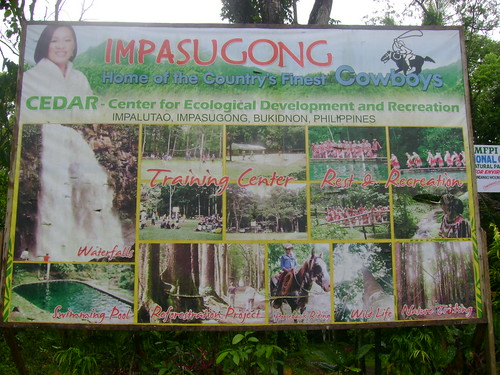
The next morning, is the completion of our traverse. We are about to exit at Barangay Bul-ogan, the entry point of Group 2. After having our breakfast and breaking camp, we took some pictures with some other groups. What a camaredie atmosphere there where you can see all smiles and jokes. I know, for two reasons, we all survived the K2D traverse and we all experience the beauty of nature throughout the trail. By 9:00 am, the lead pack signaled that we may now start the descent. We joined the few others who made the early plunge together with the two NORMMS personnel. After two hours of trek, we reached the Alanit River, the first source of water if you are climbing Dulang via Bul-ogan. By past 12:00 pm, we were at the junction of the forest and the pilot road that leads towards the main street of the barangay. It took us 2 hours more to complete that last stech down to the waiting shed where we are to wait for our trucks that will bring us to Center for Ecological Development and Recreation (CEDAR) situated in Impasugong. This is where we are to have our culminating activity, our pre-arranged dinner, certificate and t-shirt giving and the socials.
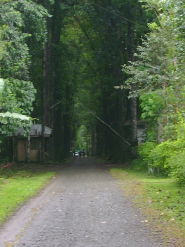
As soon as we arrived at CEDAR, I noticed that tents are pitched all over the place of the center. I soon realized that this is where all of the groups are meeting together after our respective adventures. The place is really unique with tall trees lined up as you enter the compound. There are water falls and swimming pool within the area. How I wish that we still have time to explore these places during our stay but time really constrained us. Well, that night is a social and party night as most of the participants celebrated the success of the congress. I believe everyone has reasons to rejoice. Raindrops continues until daybreak. I suppose its a sign of blessing for all of us. We departed the place for Cagayan by 8 am with memories of the beautiful things that happened to us at Bukidnon. My salute to the members of NORMMS, EFI for a job well done, and my congratulations to all the participants of the 30th MFPI Congress and Climb. I hope we'll see each other soon some other place, some other time.